
Our story
Faith and justice. Always intertwined.
Since 1849, Siloam has been a place of refuge, courage, and community. Our story is woven into the story of Brooklyn—and the ongoing work of justice.
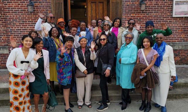
1849
A congregation begins.
Rev. James A. Gloucester, a former slave and the son of John Gloucester, founder of the First African Presbyterian Church in Philadelphia, obtained permission from Presbytery to organize his religious society into a church: the Siloam Presbyterian Church of Brooklyn. For at least two years before that, the group had held services as a mission.
1850s
A refuge on the road to freedom.
In resistance to slavery, Siloam participated vigorously in the Underground Railroad; escaped slaves were provided food, clothing and refuge. Rev. Amos N. Freeman met the abolitionist John Brown, who stayed at the Freeman home in Brooklyn on his way to Harpers Ferry; an offering of approximately twenty-five dollars was raised for him to continue his work.
Late 1800s
The Literary Union.
Organized at Siloam, the church's Literary Union successfully waged a campaign against segregation in the public school system, fought for the appointment of qualified Black school teachers, and labored to create sentiment for the passage of the 14th and 15th Amendments to the U.S. Constitution.
1919–1947
Rev. George Shippen Stark.
Under Rev. Stark, Siloam acquired a manse on Clifton Place and, in 1944, purchased the former Central Presbyterian Church at 260 Jefferson Avenue, moving closer to Brooklyn's growing African American community. The mortgage was paid off in 1945.
1948–1988
Rev. Dr. Milton A. Galamison.
Rev. Galamison served for forty years and became nationally known as one of the earliest Black leaders of the 1950s–60s civil rights era in New York City, fighting for equal opportunity in education and employment. A pioneer in religious television, he led Siloam to become the first Black church to appear on NBC.
1990–2001
Rev. Sylvester L. Shannon.
Rev. Shannon's leadership emphasized intergenerational worship, evangelism and outreach. The African American Moment and Our Time with the Children became part of Sunday services, and the "Footprints of Our History" exhibit, with artifacts dating back to slavery and the post-slavery era, was begun.
2004–2013
Rev. Dr. Darryll Young.
His tenure included the free "Meet Your Neighbors" community breakfast, sponsored by the Membership Committee, and since 2007 the Your Body Is a Temple health ministry has served the community with health information and free screenings.
2017
Rev. Eric A. Thomas.
Rev. Eric A. Thomas, the first pastor ordained at Siloam and its first openly same-gender loving pastor, leads the congregation today.
Meet our pastor
The Pastors of Siloam
- James A. Gloucester1849–1851
- Amos N. Freeman1852–1860
- C. H. Thompson1860–1863
- W. H. Dickerson1886–1892
- W. R. Lawton1892–1895
- William Alexander1896–1915
- J. E. Harper1915–1919
- George Shippen Stark1919–1947
- Milton A. Galamison1948–1988
- Sylvester L. Shannon1990–2001
- Darryll H. Young2004–2013
- Eric A. Thomas2017–present
The homes of Siloam
From rooms on Fulton Street and Myrtle Avenue to Jefferson Avenue, Siloam has had many homes. No picture of the earliest rooms and no photograph of the church on Prince Street has been found, so the oldest views here are maps. Select any image to see it larger.
1850 to 1907
Prince Street
Between Myrtle Avenue and Willoughby Street. The first church came down in 1891, and in 1897 Siloam was worshipping in the basement of its unfinished church. The 1904 map names Siloam on the lot the older maps call the African church.
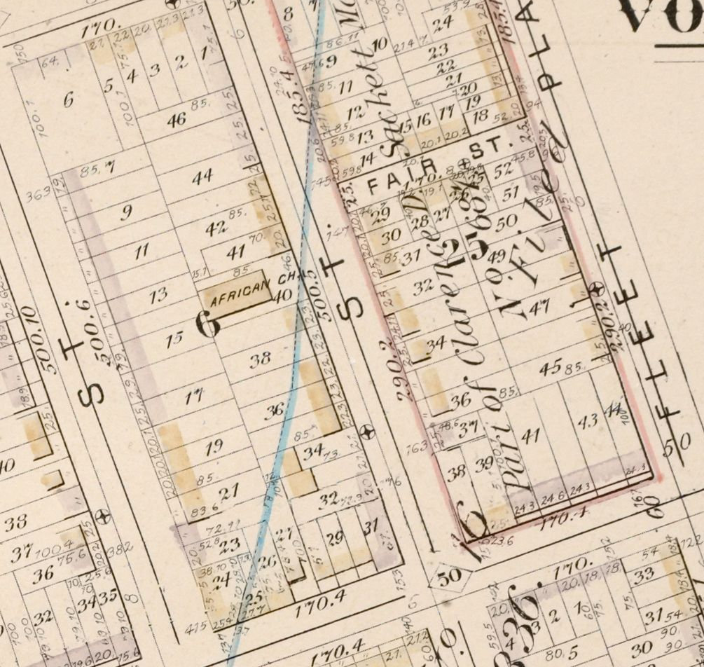
Prince Street between Myrtle Avenue and Willoughby Street on an 1880 atlas plate. The label reads African Ch. 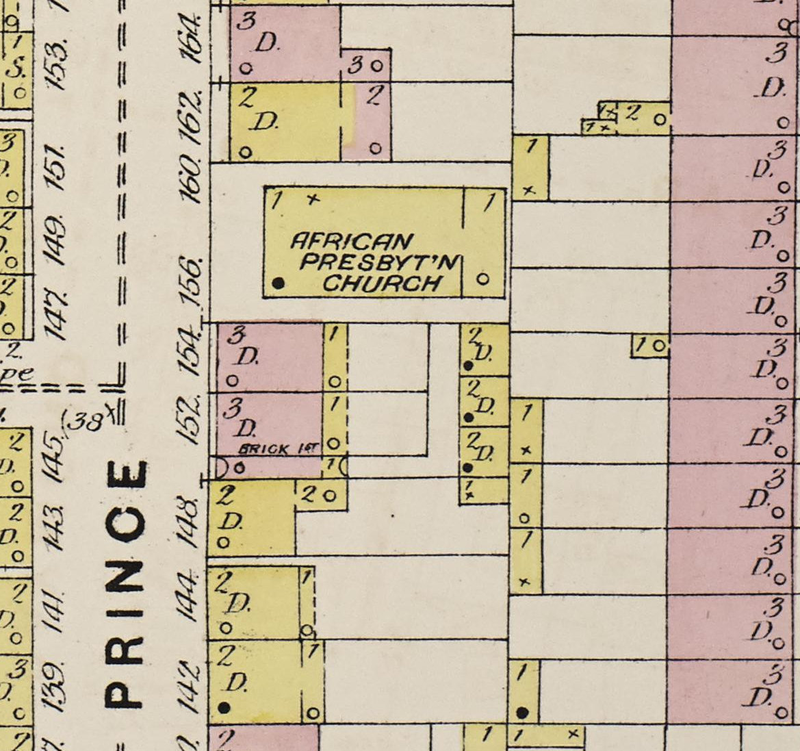
Prince Street between Myrtle Avenue and Willoughby Street on an 1887 fire insurance map. The label reads African Presbyt'n Church. 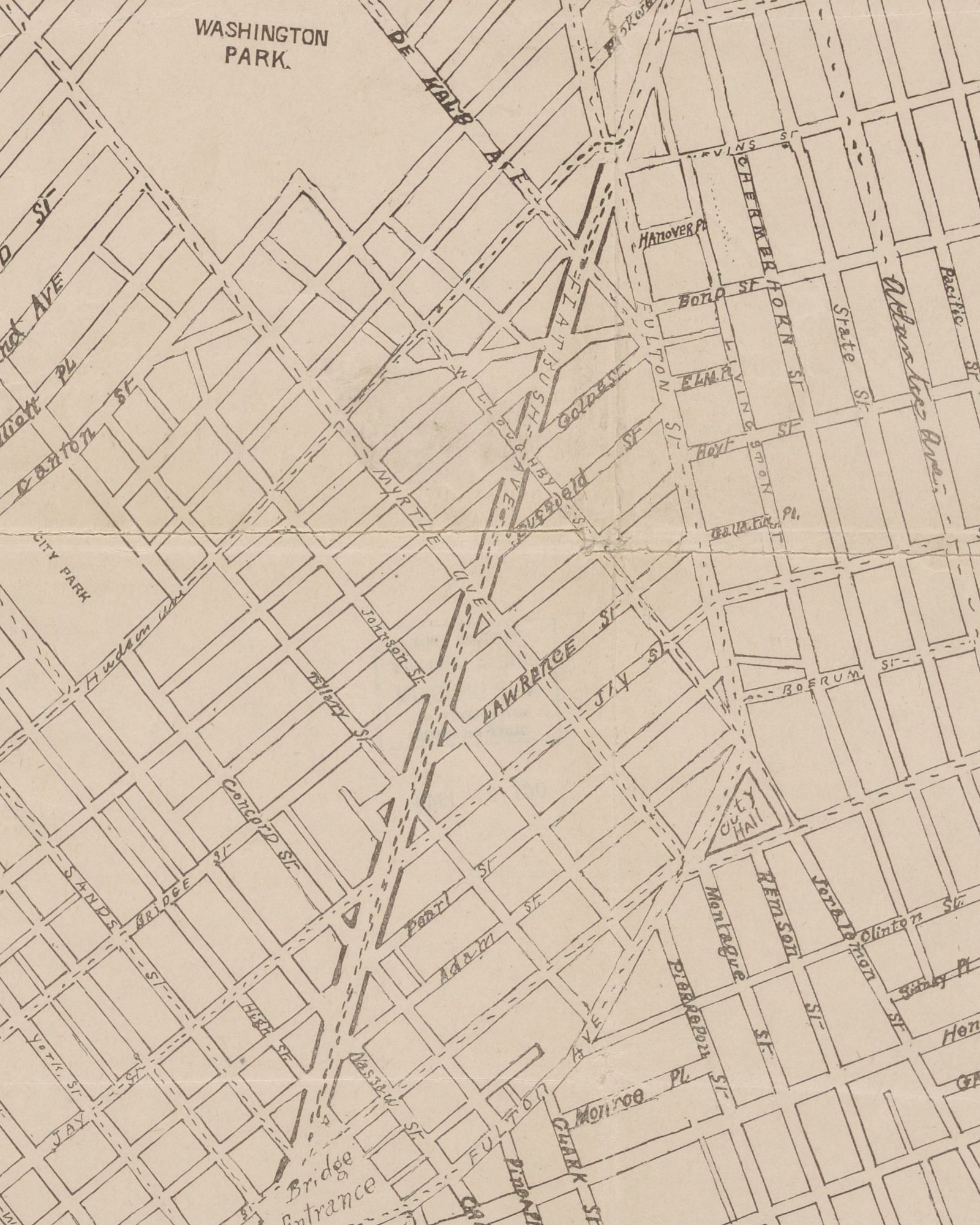
Map of a proposed extension of Flatbush Avenue to the Brooklyn Bridge, about 1900. A proposal, not the road as built. 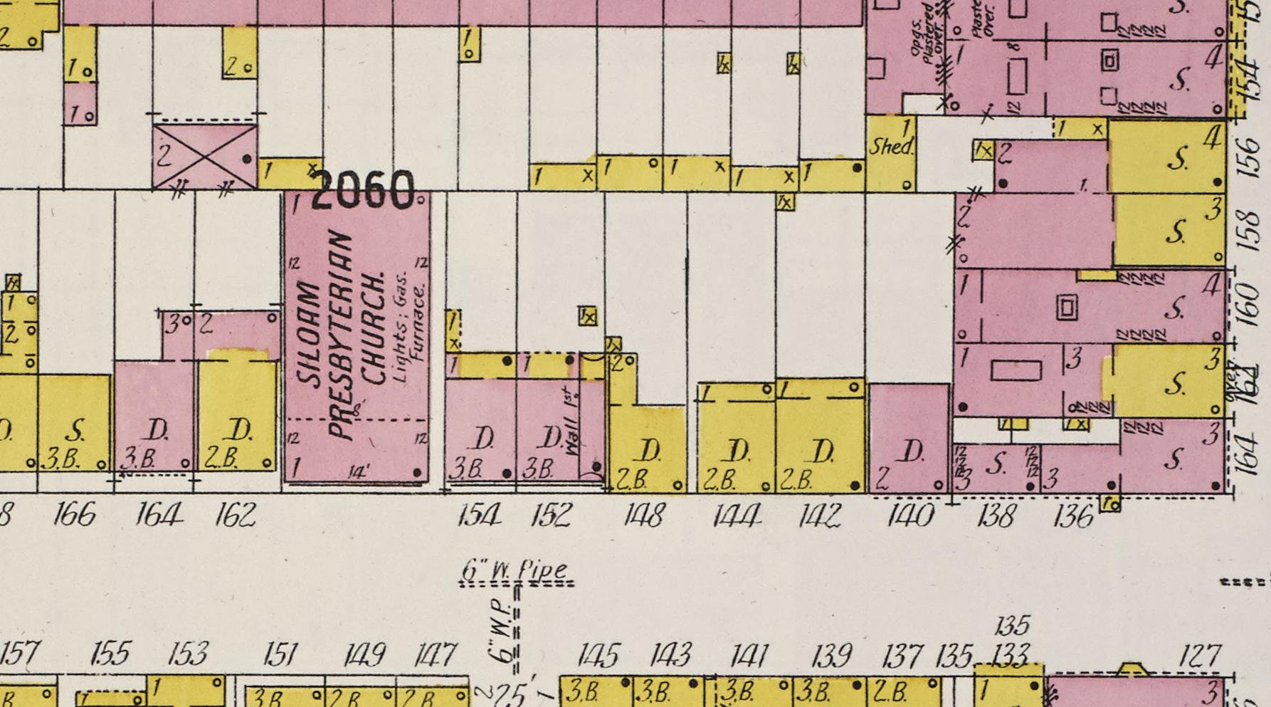
Siloam Presbyterian Church on Prince Street, named on a 1904 fire insurance map. 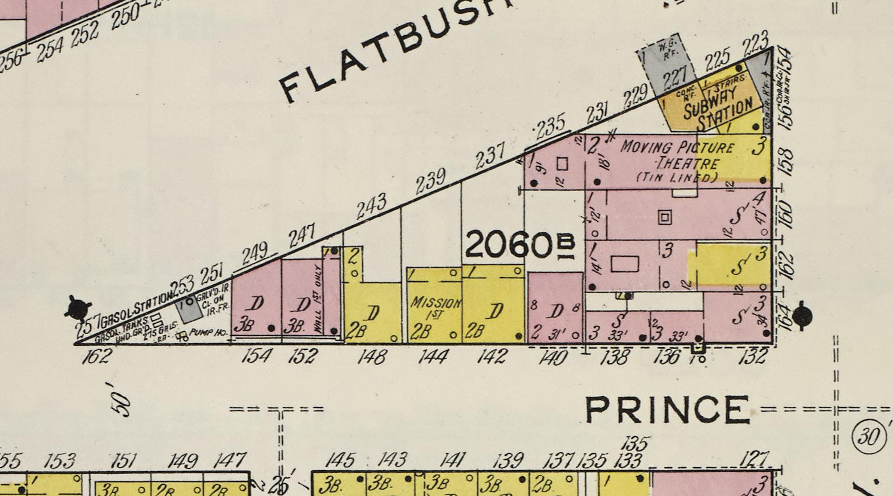
Prince Street on a 1915 fire insurance map, with Flatbush Avenue Extension cut through. Siloam had left in 1907.
Image credits: Detailed estate and old farm line atlas of the city of Brooklyn, Vol. 5, Plate F, G.M. Hopkins & Co., 1880. From The New York Public Library · Sanborn Fire Insurance Map from Brooklyn, Kings County, New York, Vol. 2, 1887, plate 45. Library of Congress, Geography and Map Division, Sanborn Maps Collection · Map showing proposed extension of Flatbush Avenue to Brooklyn Bridge, about 1900. From The New York Public Library · Sanborn Fire Insurance Map from Brooklyn, Kings County, New York, Vol. 2, 1904, sheet 32. Library of Congress, Geography and Map Division, Sanborn Maps Collection · Sanborn Fire Insurance Map from Brooklyn, Kings County, New York, Vol. 2, 1915, sheet 32. Library of Congress, Geography and Map Division, Sanborn Maps Collection
1910 to 1944
404–408 Lafayette Avenue
Built in 1897 for First Church of Christ, Scientist. Siloam bought it in 1910. These 1908 maps show it two years before the move, and the city's tax photograph shows it in Siloam's years.
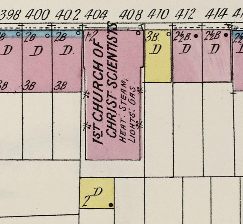
404–408 Lafayette Avenue on a 1908 fire insurance map, labelled 1st Church of Christ Scientists. Siloam worshipped here from 1910 to 1944. 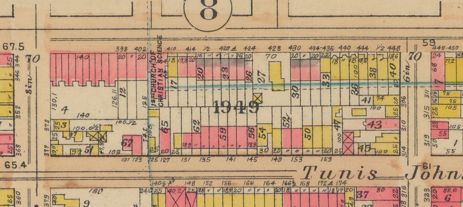
404–408 Lafayette Avenue on a 1908 atlas plate, labelled 1st Church of Christian Science. Siloam moved here in 1910. 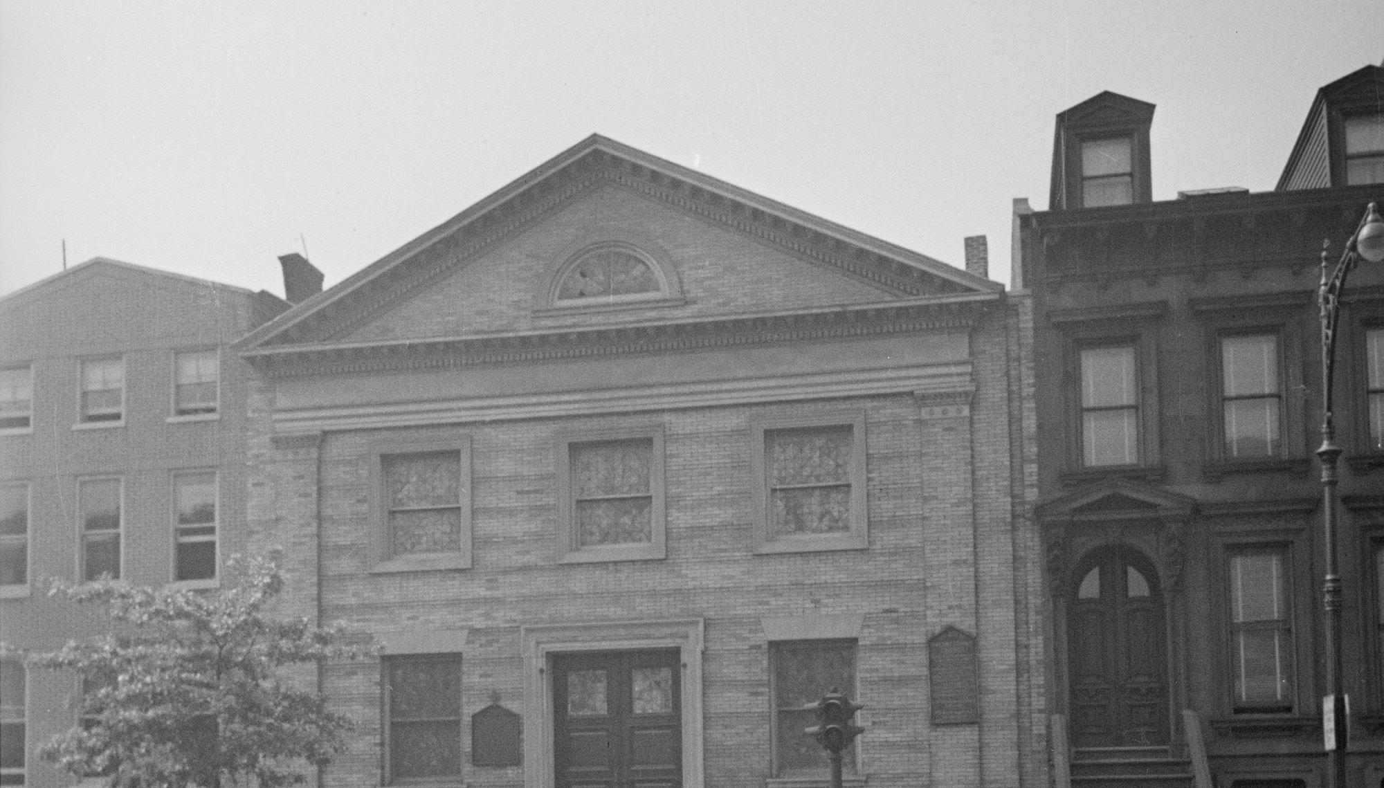
404–408 Lafayette Avenue, Siloam's home before Jefferson Avenue.
Image credits: Sanborn Fire Insurance Map from Brooklyn, Kings County, New York, Vol. 5, 1908, sheet 1. Library of Congress, Geography and Map Division, Sanborn Maps Collection · Atlas of the borough of Brooklyn, Vol. 1, Plate 7, G.W. Bromley & Co., 1908. From The New York Public Library · 404-8 Lafayette Avenue, 1940s Tax Department photographs, Courtesy of the Municipal Archives, City of New York
1880 to 1936
Jefferson and Marcy Avenues, before Siloam
Where Siloam worships today. Trinity Presbyterian's chapel stood here, then a large church of 1897 built for Central Presbyterian. Siloam never worshipped in that church. Fire destroyed it in 1936, and Siloam bought the church built in its place in 1944.
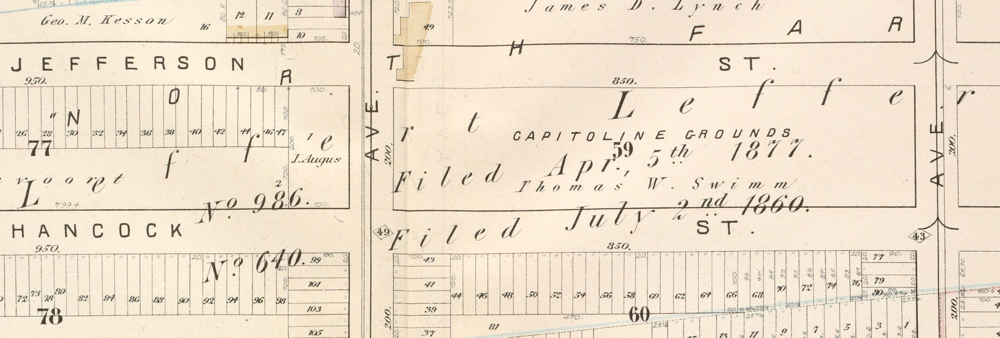
The block where the church stands today, Jefferson to Hancock between Nostrand and Marcy, on an 1880 atlas plate. 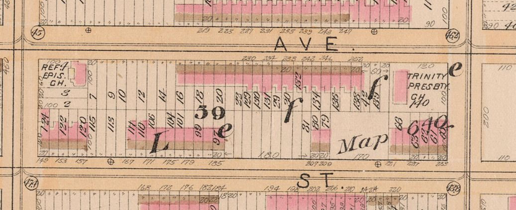
The corner of Jefferson and Marcy Avenues on an 1886 atlas plate. 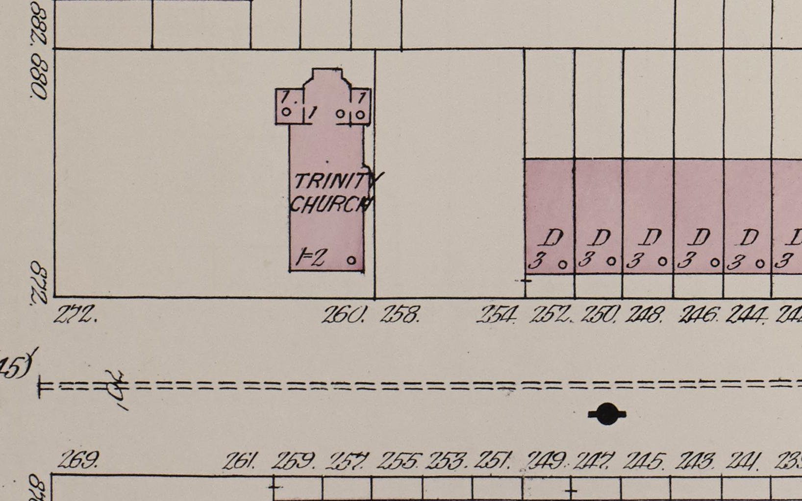
The corner of Jefferson and Marcy Avenues on an 1888 fire insurance map, with Trinity Presbyterian's chapel. It was torn down for the church of 1897. 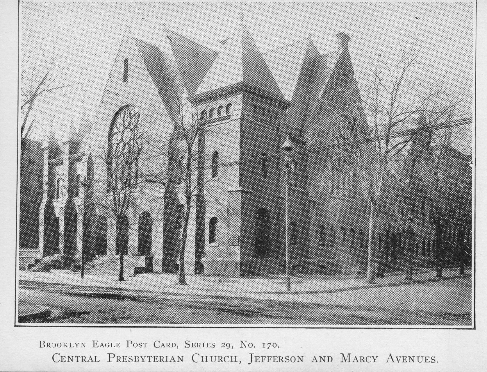
Brooklyn Eagle postcard of the earlier church at Jefferson and Marcy Avenues. Siloam never worshipped in this church. 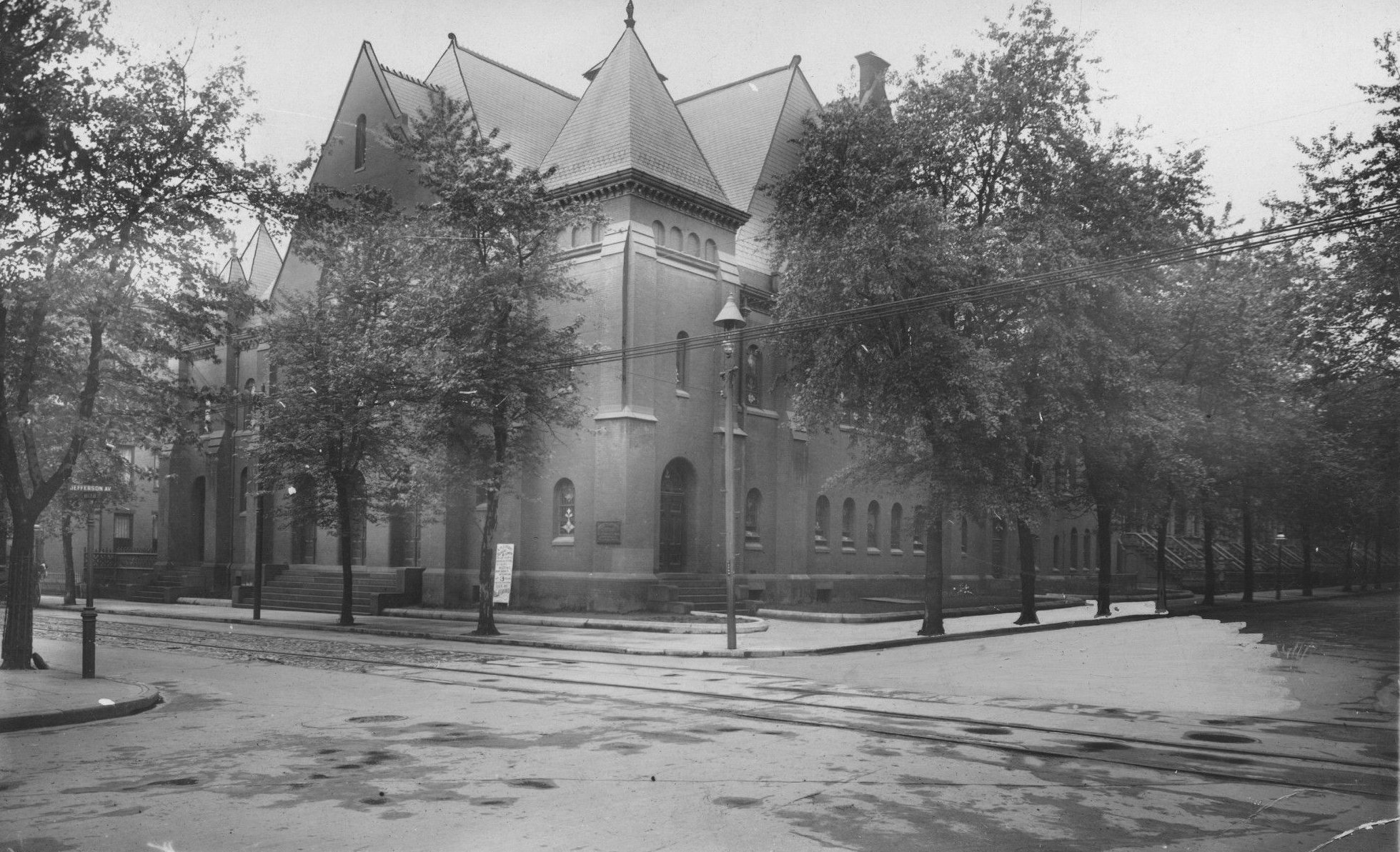
The church of 1897 in summer, with the Jefferson Avenue street sign at left. Siloam never worshipped in this church. 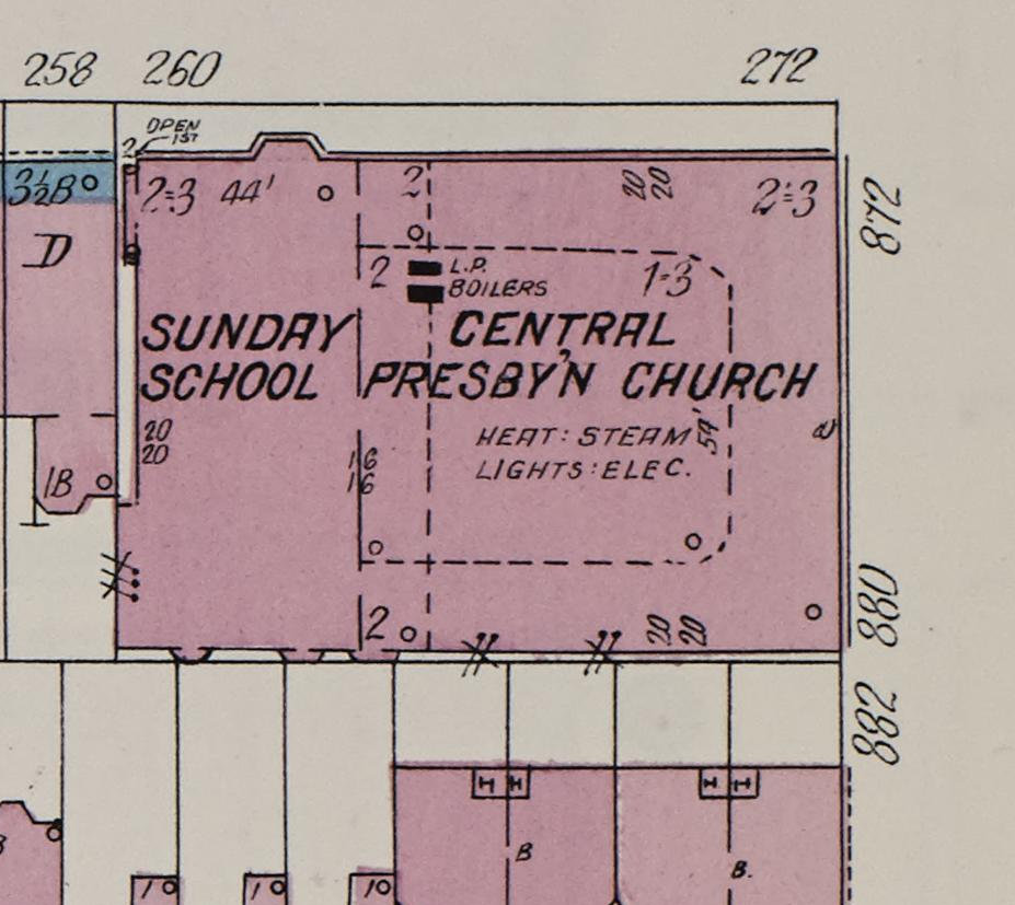
The church of 1897 on a 1908 fire insurance map, at Jefferson and Marcy Avenues. Siloam never worshipped in this church. 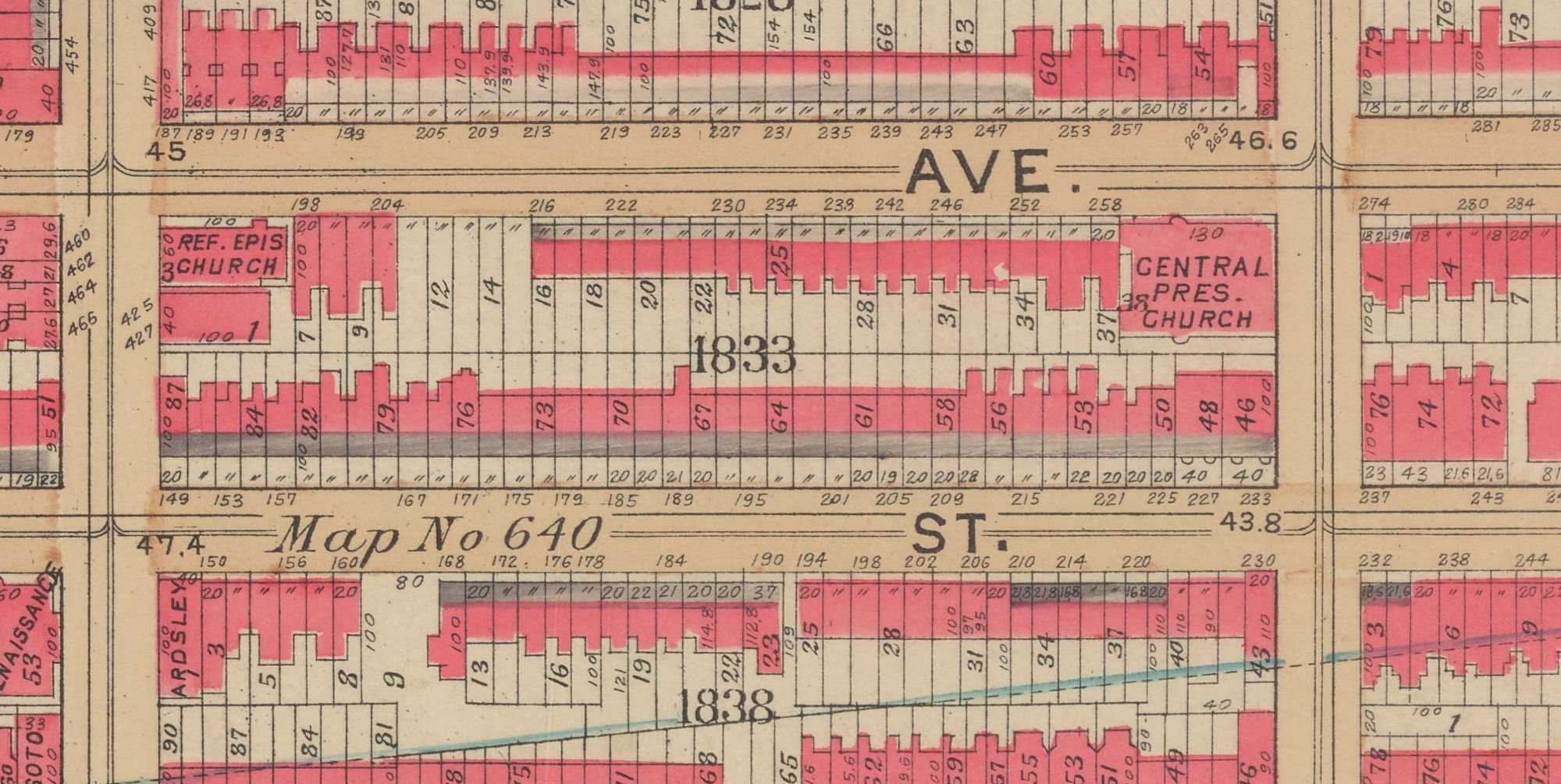
The corner of Jefferson and Marcy Avenues on a 1908 atlas plate, labelled Central Pres. Church. Siloam never worshipped in this church. 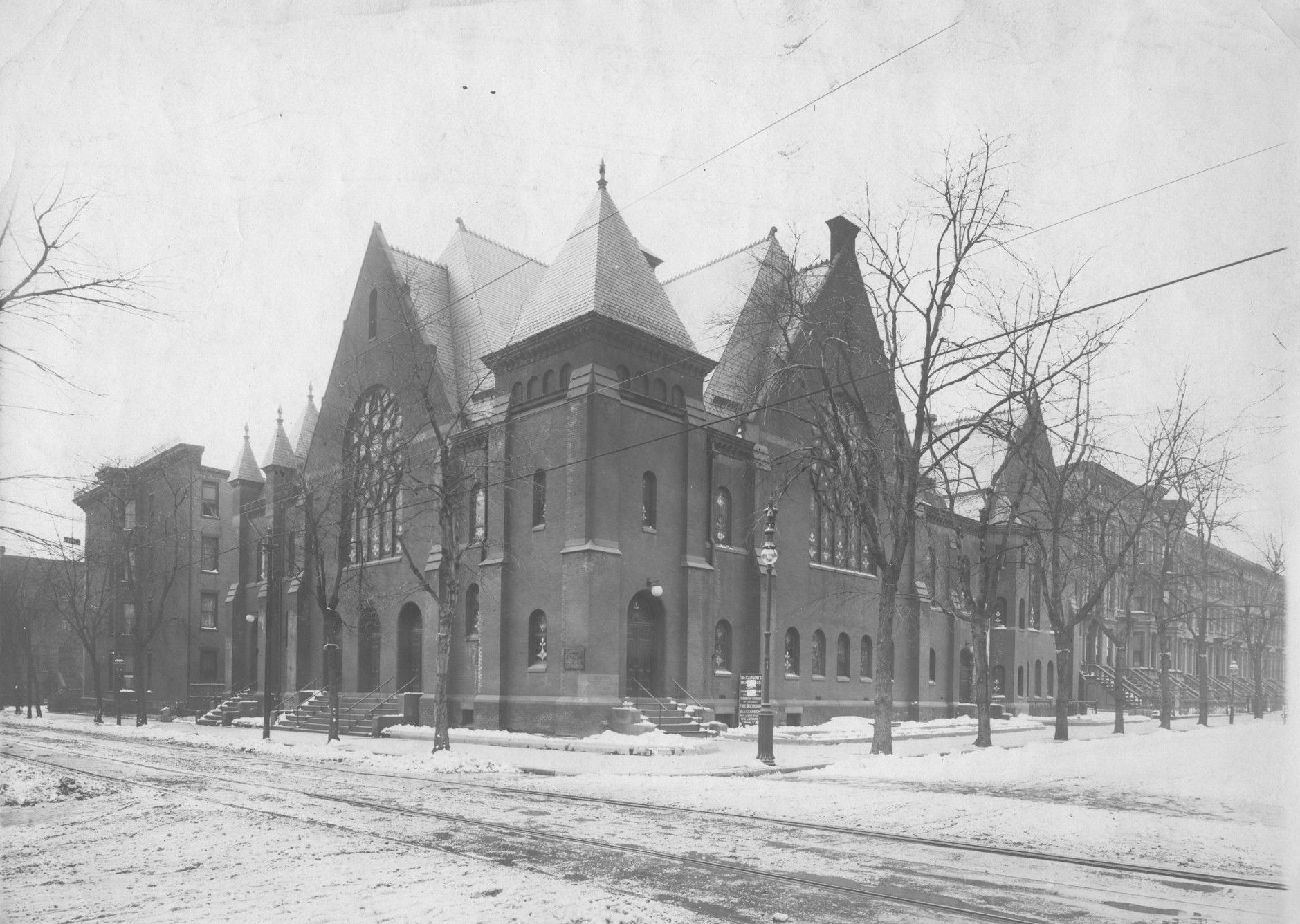
The church of 1897 at Jefferson and Marcy Avenues, in snow. Siloam never worshipped in this church; fire destroyed it in 1936. 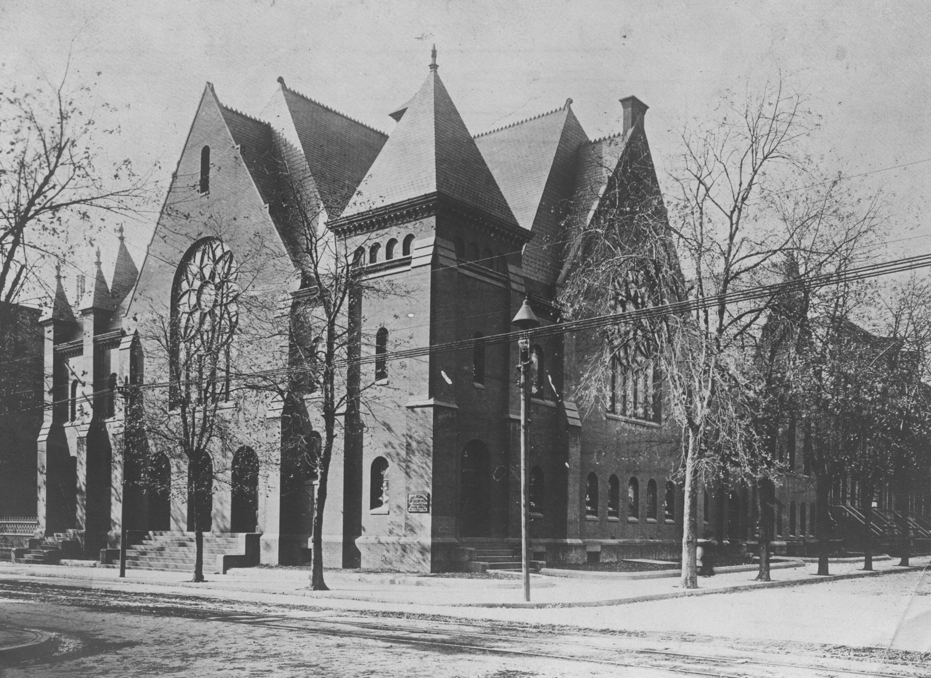
The church of 1897 at Jefferson and Marcy Avenues. Siloam never worshipped in this church.
Image credits: Detailed estate and old farm line atlas of the city of Brooklyn, Vol. 1, Plate D, G.M. Hopkins & Co., 1880. From The New York Public Library · Robinson's atlas of the city of Brooklyn, Plate 7, E. Robinson Co., 1886. From The New York Public Library · Sanborn Fire Insurance Map from Brooklyn, Kings County, New York, Vol. 5, 1888, plate 112. Library of Congress, Geography and Map Division, Sanborn Maps Collection · Brooklyn Eagle Postcard collection, Brooklyn Public Library, Center for Brooklyn History, POST_0386 · Brooklyn Daily Eagle photographs, Brooklyn Public Library, Center for Brooklyn History, CHUR_1092 · Sanborn Fire Insurance Map from Brooklyn, Kings County, New York, Vol. 5, 1908, sheet 30. Library of Congress, Geography and Map Division, Sanborn Maps Collection · Atlas of the borough of Brooklyn, Vol. 1, Plate 7, G.W. Bromley & Co., 1908. From The New York Public Library · Brooklyn Daily Eagle photographs, Brooklyn Public Library, Center for Brooklyn History, CHUR_1090 · Brooklyn Daily Eagle photographs, Brooklyn Public Library, Center for Brooklyn History, CHUR_0527
since 1944
260 Jefferson Avenue
Built for Central Presbyterian after the fire. Siloam bought it in April 1944 and paid off the mortgage in October 1945.
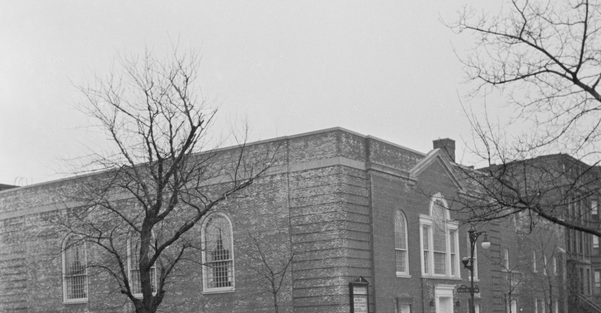
Today's building when it was still Central Presbyterian Church, before Siloam bought it. 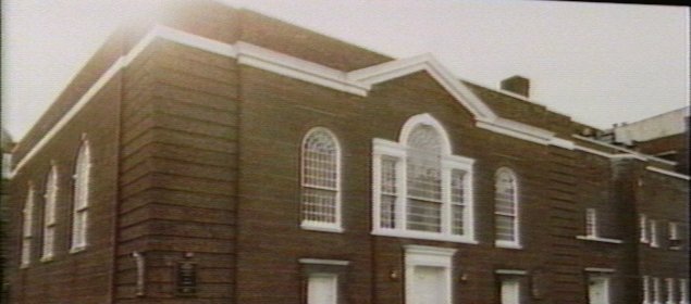
260 Jefferson Avenue in the 1980s, in Siloam's years here. City tax photograph. 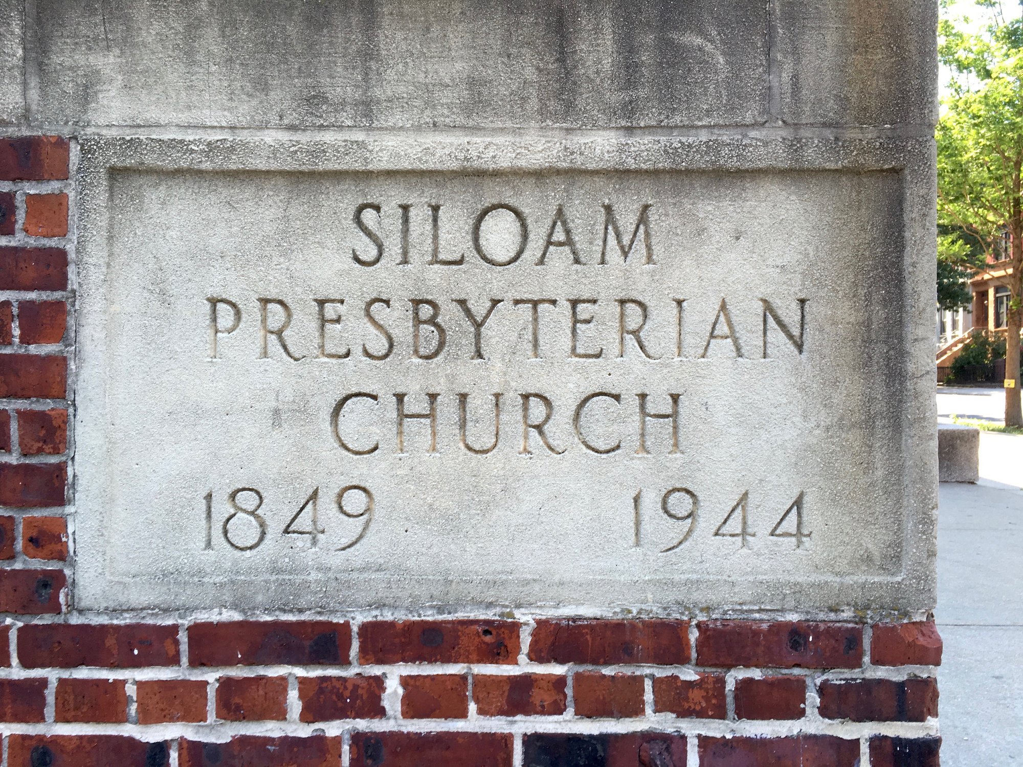
The cornerstone: Siloam Presbyterian Church, 1849, 1944. 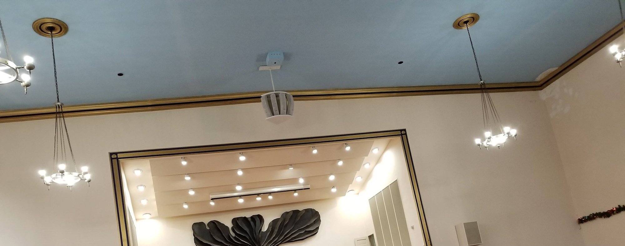
The sanctuary ceiling and chandeliers, looking toward the chancel. 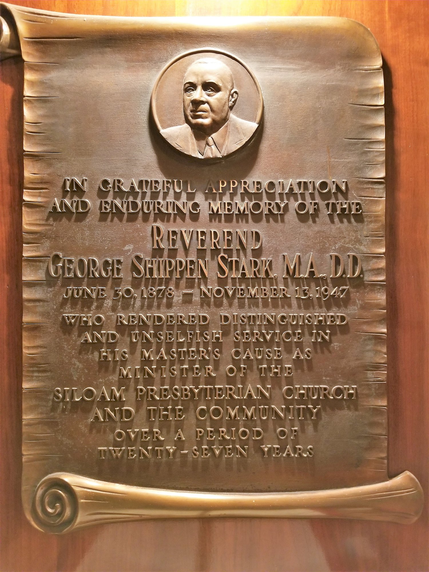
Memorial plaque to Rev. George Shippen Stark. 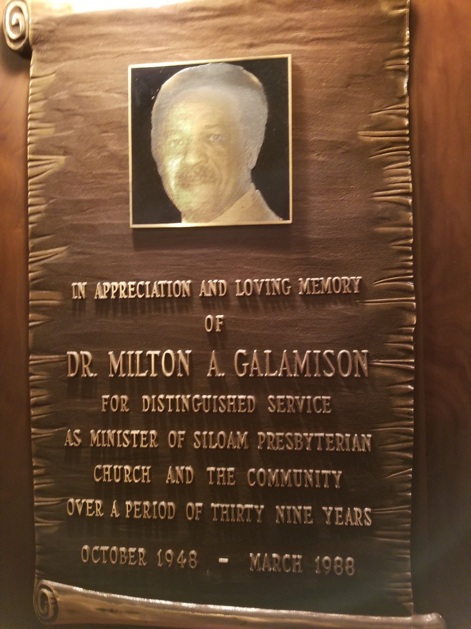
Memorial plaque to Dr. Milton A. Galamison. 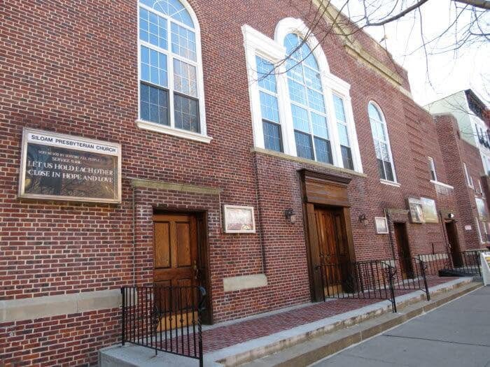
The Jefferson Avenue front.
Image credits: 260-70 Jefferson Avenue, 1940s Tax Department photographs, Courtesy of the Municipal Archives, City of New York · 260-70 Jefferson Avenue, 1980s Tax Department photos, Courtesy of the Municipal Archives, City of New York · "Siloam Presbyterian Church" by Stephen Coles, CC BY-NC-SA 2.0 (creativecommons.org/licenses/by-nc-sa/2.0), via Flickr · Siloam Presbyterian Church
A place for you. A purpose we share.
Let’s take the next step together.